Severe Thunderstorms Could Bring Damaging Winds, Heavy Rain to Southern Ohio Tuesday
CHILLICOTHE, Ohio — Residents across southern Ohio should prepare for the possibility of severe thunderstorms Tuesday afternoon and evening, with damaging winds expected to be the primary hazard.
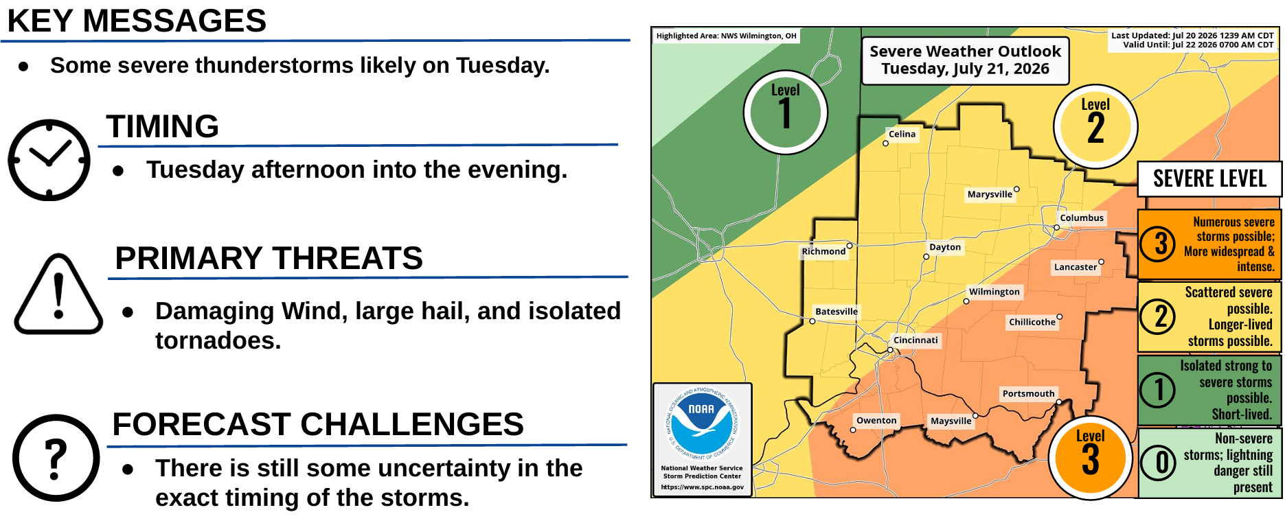
According to the National Weather Service in Wilmington, thunderstorms are expected to develop and overspread the region throughout the day. Some storms could become severe during the afternoon and evening hours.
Forecasters say damaging straight-line winds pose the greatest threat, with the potential for numerous downed trees and power lines and possible structural damage. The highest risk extends across much of the National Weather Service's forecast area, particularly along and southeast of Interstate 71, which includes much of the Signal 740 coverage area.
In addition to strong winds, isolated storms may produce large hail, while a few tornadoes cannot be ruled out. Forecasters also warn that some storms could produce very heavy rainfall, leading to localized flash flooding in low-lying and poor drainage areas.
The National Weather Service has placed the region under a Level 2 of 5 (Slight Risk) for severe weather, indicating scattered severe storms are possible, with some storms capable of becoming longer-lived.
There remains some uncertainty regarding the exact timing of storm development, but the greatest threat is expected from Tuesday afternoon through Tuesday evening.
Residents are encouraged to monitor the latest forecasts throughout the day, have multiple ways to receive weather warnings, and be prepared to seek shelter quickly if severe weather approaches.
Primary Threats
Damaging wind gusts
Large hail
Isolated tornadoes
Heavy rainfall and localized flash flooding